BUFFALO, N.Y. — While West Michigan is getting hit by several inches or possibly over a foot of snowfall, in Buffalo, NY, just a foot would be welcomed news. As of Thursday evening they are preparing for several feet of snowfall, and most of it coming through lake-effect.
The Question:
Just what is making lake-effect so much more intense in Buffalo than in West Michigan?
The Why:
When looking at things on the surface, the snowfall setup in western New York is very similar to ours here in West Michigan. In fact, the upper-air temperatures, water temperatures on the Great Lakes and wind forecast are all about the same.
So what gives? What's the difference here?
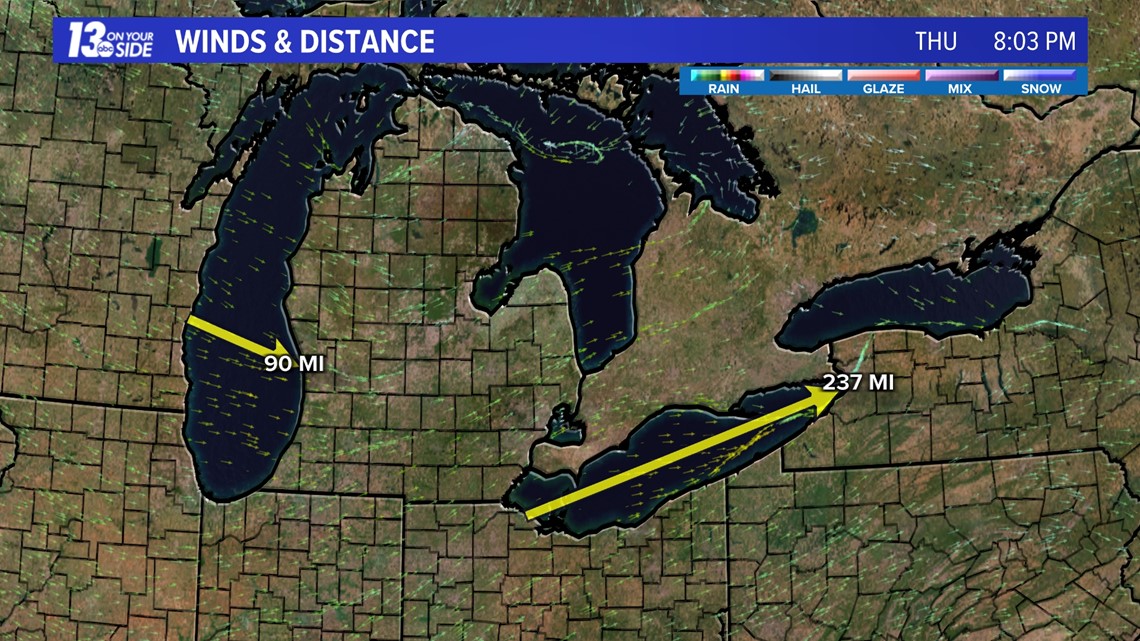
The difference is something called fetch, or the distance that the winds travel across the water before they come onshore. The longer this distance, the more the clouds can build, the more moisture they can pick up, and the more snowfall they can dump.
Across Lake Michigan and into our area, this distance is roughly 90 miles. In western New York, the distance over Lake Erie is over 230 miles! This is over 2.5 times the distance and the travel time to pick up moisture and generate lake-effect snow!


While there are other forecast differences that are impacting our regions, the major differentiating factor in this difference is fetch. So at the end of the day, be thankful we are only getting totals measured in inches instead of feet! 😉
-- Meteorologist Michael Behrens
Follow me on social media! Facebook Meteorologist Michael Behrens, Twitter @MikeBehrensWX, and Instagram @MikeBehrensWX.
Email me at: MBehrens@13OnYourSide.com
Have a 30-second video or still photo to share? We'd love to share it with everyone! Email your image to Weather@13OnYourSide.com or post it to our 13OnYourSide Facebook Page.
►Make it easy to keep up to date with more stories like this. Download the 13 ON YOUR SIDE app now.
Have a news tip? Email news@13onyourside.com, visit our Facebook page or Twitter. Subscribe to our YouTube channel.

