BUFFALO, N.Y. — It was a snowy and chilly Tuesday night for Halloween especially for later evening into the overnight.
The first accumulating snowfall of the season brought a coating to many and several inches of snow to some areas south and inland, especially in the hills.
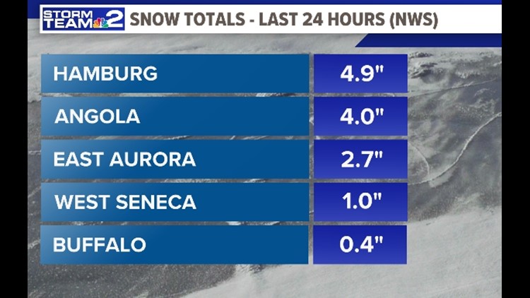
Snow totals for Western New York during Tuesday night into early Wednesday (from the National Weather Service) show some of the highest amounts of snow accumulations were found in Hamburg and Eden with nearly 5 inches of snow. Angola received 4 inches, Boston 3.1 inches.
RELATED ARTICLE: Snowy mess causes road closings and crashes
Fredonia and Cassadaga saw 3 inches, East Aurora 2.7 inches, Wales 2.4 inches, Elma 2.2 inches, and Forestville 2 inches. Also, Alexander received 1.7 inches, Attica 1.6 inches, Hamburg 1.5 inches, Glenwood 1.3 inches, Lake View 1.2 inches, West Seneca 1 inch, Cheektowaga 1 inch, and Buffalo 0.4 inch.
Another round of Lake effect snow is looking likely during Thursday morning's commute, with a quick 1 to 2 inches of snow possible late overnight and into the morning. Southwesterly winds are going to develop late Wednesday night, and given that Lake Erie is still relatively warm, a band of lake effect snow is expected to develop.
The band of snow will form across the Southern Tier and southern Erie County early Thursday morning. That band of snow will lift over the Southtowns, near daybreak, and then continue to lift into the Buffalo metro area, possibly in time for the morning drive. plan accordingly for a possible slick morning commute once again.


