BUFFALO, N.Y. — Western New York is used to wacky, changeable weather. We’ve got everything from heat waves, to blizzards, to seiches, even an occasional tornado. Last week’s wind and lake effect certainly fit into most people’s mental picture of our area of the world this time of year, but that wind and snow produced a pretty unusual phenomenon.
RELATED: Forecasting lake effect snow
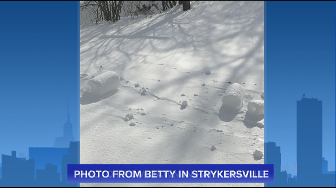
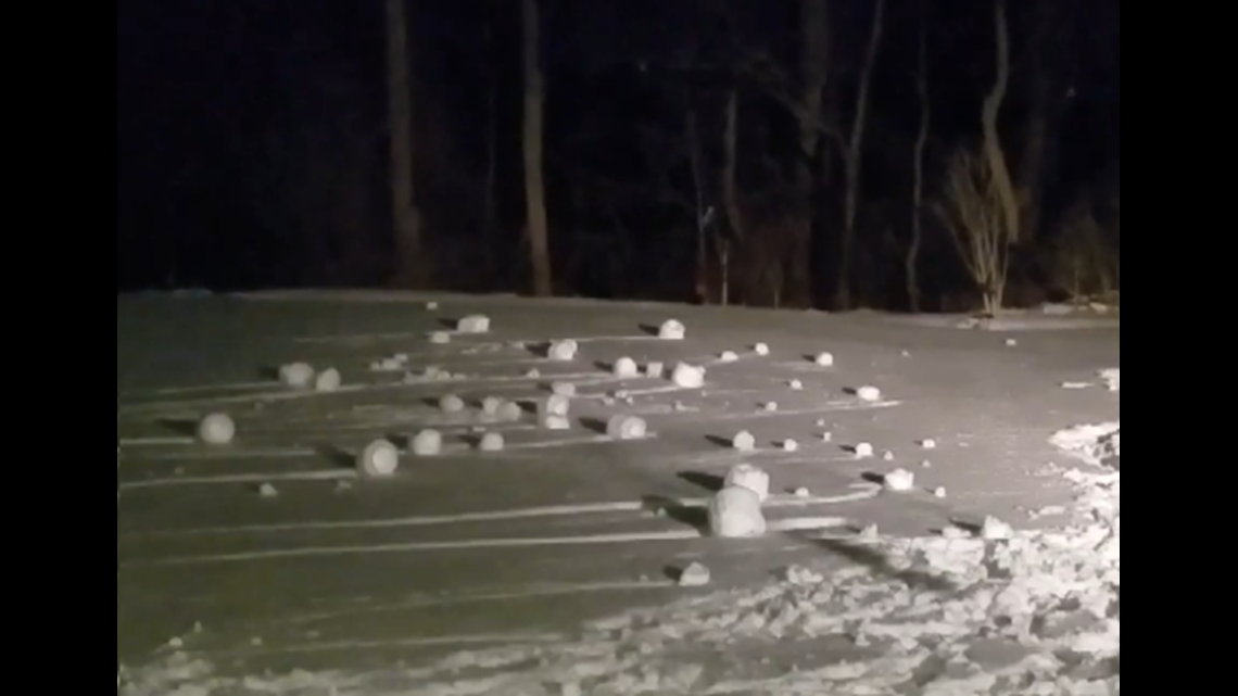
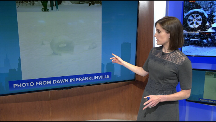
Several WGRZ viewers sent in pictures of what look like “donuts” made of snow standing upright in their yards. In some cases, there were several of these little “donuts” in one photo, and a few appeared to have rolled right along on their own!
No, it’s not some paranormal winter activity, but it is pretty weird, even for our standards. Those viewer photos showed what are technically known as “snow rollers.”


Several weather factors had to line up at just the right time for these rollers to form on Friday. First, a persistent cold and snowy pattern had to build up a snowpack. By last Thursday, February 4, much of the Southern Tier had at least 6 inches on the ground. That snowpack had been melting and refreezing and was pretty much frozen solid by Friday morning.
Last Friday morning brought an early round of wet snow. Only a couple of inches accumulated, but it was enough to build a layer of fairly loose snow on top of that solid snowpack underneath. The snow had just enough moisture for the flakes to glom together, but not so much that it turned into a sloppy slush. In other words, it was good “snowball making” snow.
The final key was a strong and steady wind. We certainly got that last Friday with gusts at the Buffalo Airport peaking in the 50 to 60 mph range. Winds weren’t that intense in the interior Southern Tier, but they were persistent enough to get that loose, top layer of snow moving. The wind actually pushed the snow up and over itself, creating the snow rollers and in some cases, rolling them right along for a few more feet!
RELATED: What makes the wind blow?
Snow rollers tend to be a little more common out in the Plains and Midwest where there’s plenty of wide open space and frequent snow-making systems throughout the winter. It was cool to see them reported in our neck of the woods for a change.
Remember if you have weather photos to share with Storm Team 2, you can tweet them using #beon2, send them to our Facebook pages or upload them right to the WGRZ app using the “Near Me” feature.
New episodes of Heather’s Weather Whys are posted to the WGRZ YouTube channel every Wednesday evening. If you have a weather question for Heather to answer, send it to her at heather.waldman@wgrz.com or connect with her on Facebook or Twitter.


