Forecasting lake effect snow is tricky business. A short drive of a few miles can take one from just a few flurries to all-out blizzard conditions and then back again just a few miles farther.
Figuring out exactly where the most intense snow bands will set up is key to getting the forecast right. There are several factors to consider when forecasters make the call. The big ones being temperature and wind direction at several heights throughout the atmosphere.
Weather models do a decent job of predicting wind direction on a broad scale. It’s pretty easy to call whether winds will come from the south or the west. But when you’re dealing with something as impactful and as highly localized as lake effect, calling for a “west wind” just isn’t specific enough.
RELATED: Lake effect snow “prime time”
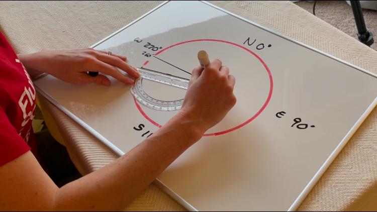
To remedy that, weather forecast models predict wind direction in degrees. Remember there are 360 degrees in a circle and in the case of cardinal directions, north is at 0 degrees, E is 90 degrees, and so on. The models predict wind direction in intervals of 10 degrees.
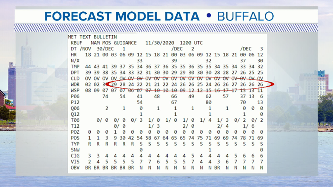
Below is an example of some data pulled from Monday’s forecast. The wind direction is circled.


A 260-degree wind, like what’s shown, tends to favor lake effect snow for the Southtowns and even South Buffalo. But models aren’t perfect.
What if the wind was actually coming from 250 degrees? That would cause a shift in where the heaviest snow would set up. The shift may only be a few miles, but as Western New Yorkers know, that can make a really big difference!
RELATED: Remembering “Snowvember”
Watch this week’s Heather’s Weather Whys to find out what wind direction may delivery lake effect snow to your region. And of course, remember, wind isn’t everything. There are a lot of other factors that have to come together to make a big snowstorm happen.
New episodes of Heather’s Weather Whys are posted to the WGRZ YouTube channel every Wednesday evening. If you have a weather question for Heather to answer, send it to her at heather.waldman@wgrz.com or connect with her on Facebook or Twitter.


