BUFFALO, N.Y. — The Setup
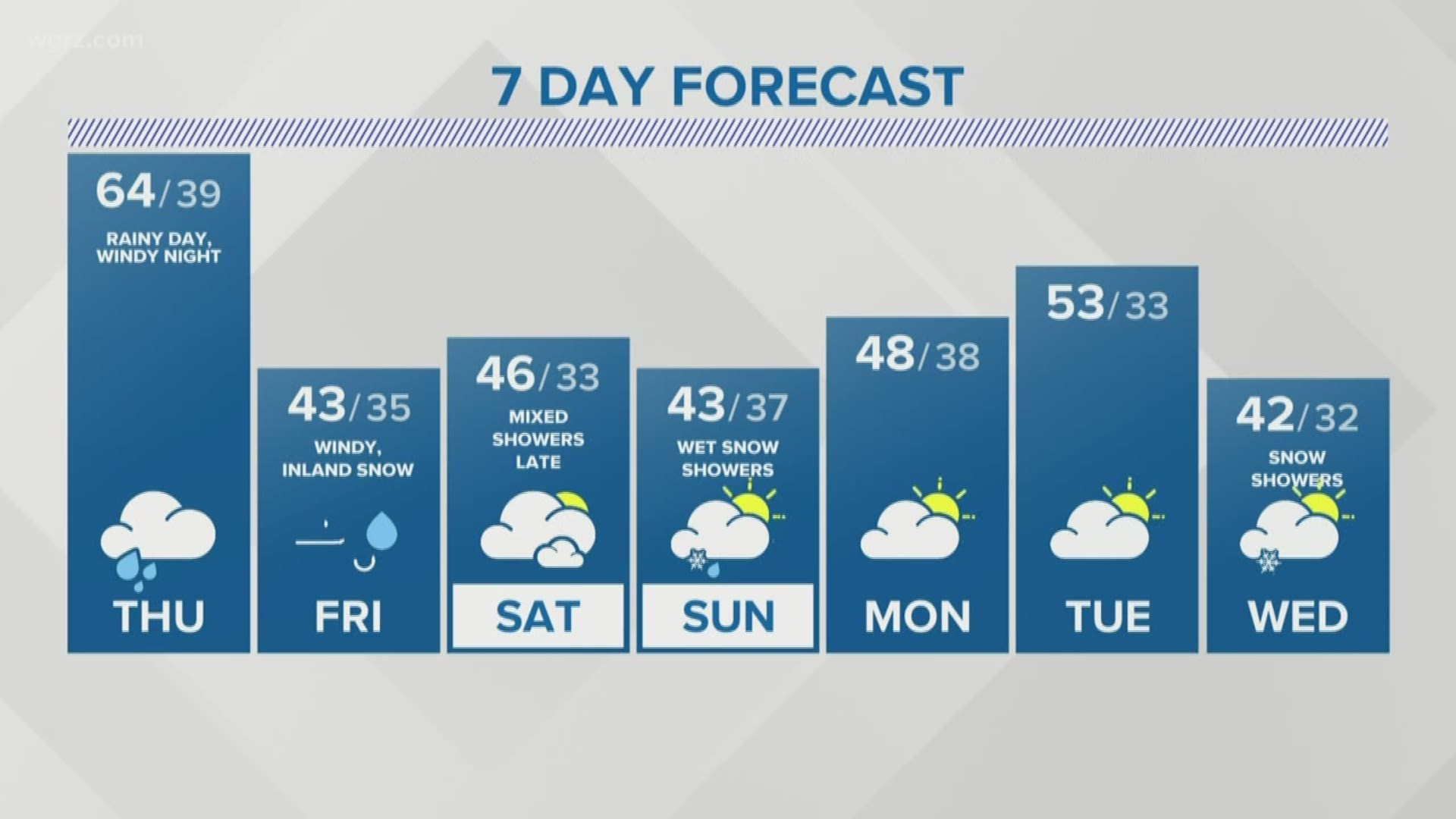
Your little ghosts and goblins may get soaked while trick-or-treating this Thursday. Wind will also be a big part of the story, but not until late tonight.
A powerful fall storm is on the way for Western New York. The storm is now over the Midwest and it is expected to strengthen as it tracks towards Western New York on today. It will bring rounds of widespread rain followed by some very high winds.
Current Advisories
There is already a High Wind Warning for all of WNY for this evening through Friday afternoon. Wind Advisories will be in effect during the same time for Potter and McKean counties in PA.. Southwest winds will howl at 35 to 45 mph with some gusts reaching 60-65 mph. The highest wind gusts are expected in the warning area with slightly less intense gusts in the advisory area.
A Lakeshore Flood warning has also been issued for coastal communities in Erie and Chautauqua counties. Significant water level increases and high waves will likely lead to flooding in those areas.
Rain Timing
At this point, it looks like the heaviest rain will fall between 11 a.m. and 6 p.m. Many areas could get up to 1 inch of rain with locally higher amounts possible.
Obviously, this timing would greatly impact Halloween activities throughout the day, but there may be some small pockets of dry time after dinner.
Wind Timing
Wind gusts will be tame most of the day, maxing out around 10 to 15 mph in the afternoon. Late this evening after the heaviest rain wraps up, the winds will increase quickly. The most intense wind gusts are likely between 12 a.m. Friday morning and 6 a.m. Friday morning. It will remain windy into the afternoon but the winds will begin to back off after 6 a.m.
This one-two punch of heavy rain followed by powerful, persistent winds will make trees much more prone to coming down. Widespread power outages are possible on Friday. Travel will likely be difficult, especially for high profile vehicles. Expect widespread delays at regional airports.
Snow Timing
We are not expecting much in the way of snow out of this system; however, there could be some snowflakes mixing in with the rain showers during the day on Friday, especially in the hills south of Buffalo.
There will be another chance of some lake effect snows developing Saturday night into Sunday morning. Some of those flakes could move into the Southtowns as well, but most of the activity should be south of Buffalo. Right now the hills of southern Erie, Wyoming, Cattaraugus and Chautauqua counties could see 1 to 3 inches of slush by Sunday morning.
Halloween History
It is not a rarity to get rain on Halloween. In fact, over the past 80 years, 40 percent of all Halloweens have had measurable rainfall. Even as recently as six years ago, over an inch of rain fell in Buffalo on Halloween in 2013.
The wind is no stranger to us this time of year either as big late-season temperature swings drive the strong storms that bring the winds along.
It will turn notably cooler this weekend with the possibility of our first flakes of the season with a mix of rain showers possible Saturday and Sunday.
RELATED: Storm Team 2 Weather Forecast

