
BUFFALO, N.Y. — Since Monday, Storm Team 2, as well as other forecasters across the region, were talking about storms which could have a big impact Wednesday afternoon.
All the ingredients were is place to bring strong to severe thunderstorms to much of WNY starting in the mid afternoon.
Even the Storms Prediction Center, a branch of the National Weather Service based in Oklahoma, had all of WNY highlighted as being at risk of severe weather with the possibility of tornados.
A cold front that descending from the upper mid-west which was separating warm, humid air over the Great Lakes from the cold air in Canada that was about 20-25 degrees cooler.
Fronts like this have a history of producing strong lines of thunderstorms in this region during the late summer/fall season.
Everything was on track Wednesday morning ,and at around 9AM, the front started producing strong thunderstorms in Michigan that were heading in our direction. Many times storms that form there can weaken before they reach WNY as they cross the cool waters of Lake Erie.
This was not the case Wednesday as the lake temperature was still in the low 70s, warm enough to sustain thunderstorms as they cross.
But then mother nature threw us a curveball.
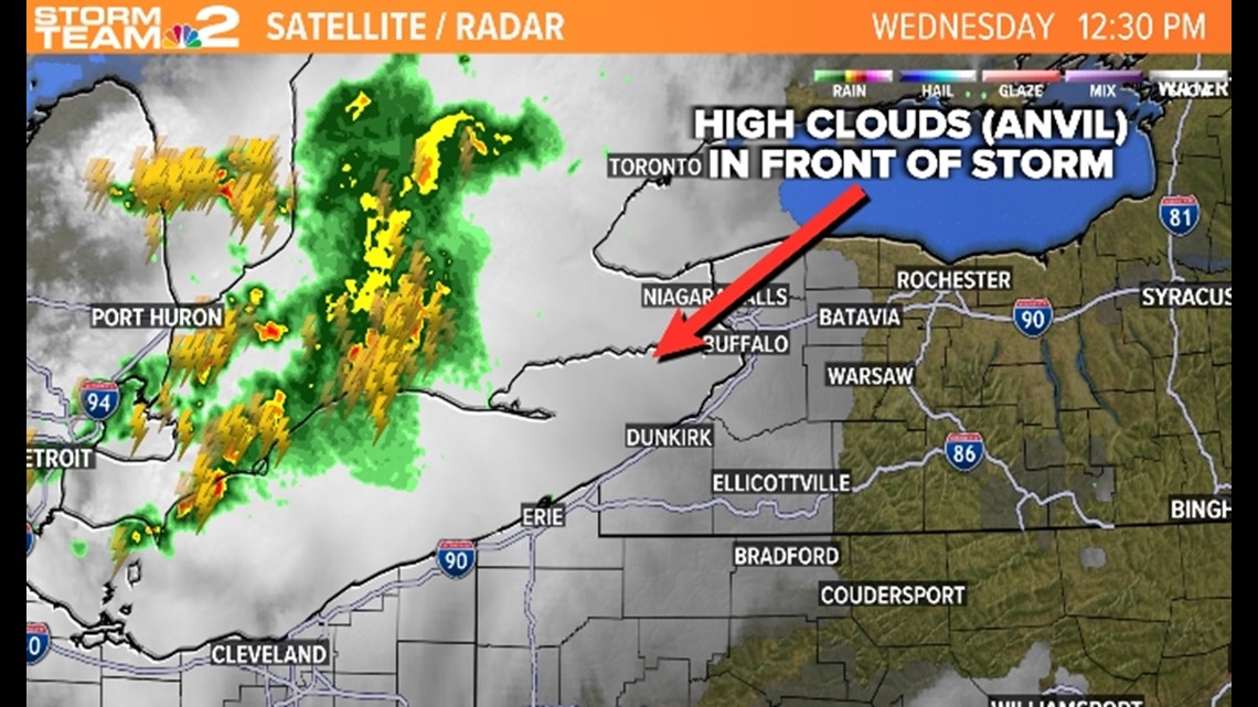
High clouds coming from the tops of these very tall thunderstorms (anvils) moved out ahead of the storms in the same direction they were traveling.
Many times these anvil clouds travel in directions away from where the storms are going. This is important because, as storms travel, they need to continue to travel into warm and humid air to sustain themselves and even grow stronger.
What these cloud did was darken the skies out ahead of these storms and cooled the atmosphere in their path, essentially cutting off the storms fuel source.
In meteorological jargon these storms "tripped over their own anvils".

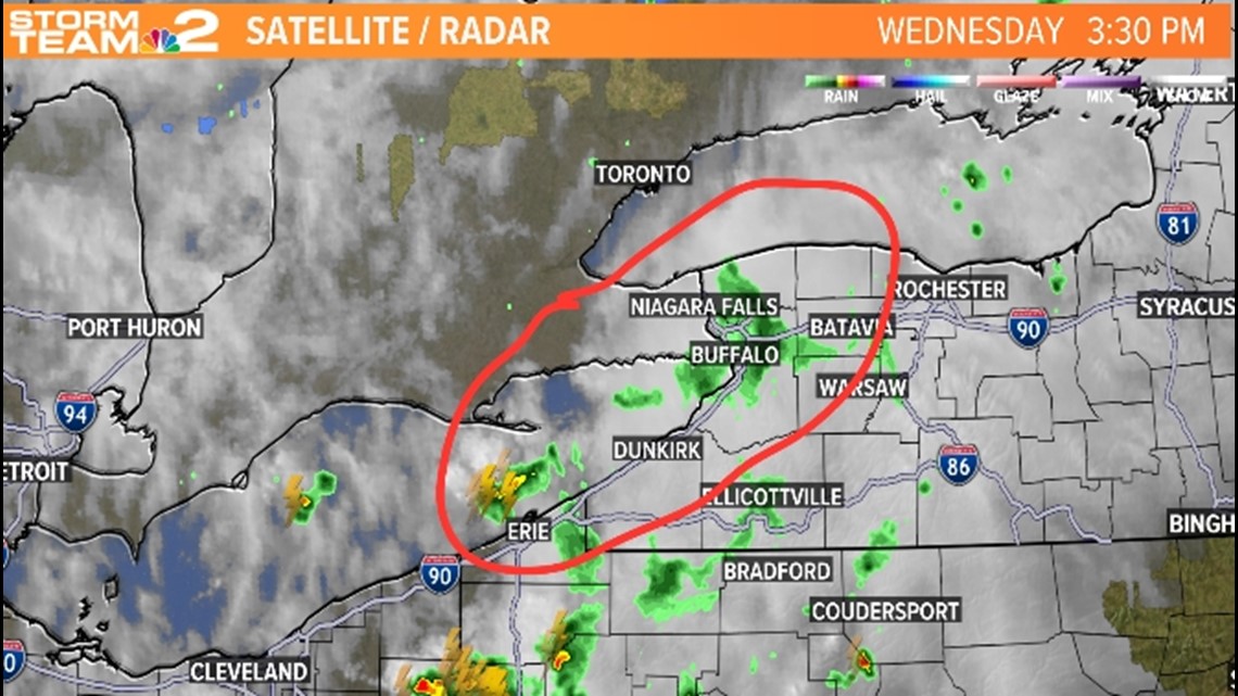
As a result, this line of strong storms completely fell apart about 75 miles west of Buffalo as they approached. They ran out of gas. All that was left, were clouds and a few light showers followed by sunshine. A far different outcome than what was possible. Had those high clouds been directed in a different direction all sorts of severe weather would have been possible.