BUFFALO, NY- — Winter 2018-2019 is certainly looking interesting. But then again, what Buffalo winter isn’t interesting?
This year may be especially so thanks to a couple of different key factors that may mix together at the right time. A developing El Niño could prove to be the key ingredient to this season’s forecast.
The term El Niño usually allows for a sigh of relief for anyone that shudders at the thought of harsh chill or piles of snow. That’s because a strong El Niño typically brings relatively mild conditions to a big part of the country. Unusually warm waters in the tropical Pacific not only define an El Niño, but ultimately lead to the large-scale temperature shift too.
But this year’s El Niño pattern will likely not follow the typical rules and that could lead to a lot of smiles, rather than sighs for winter weather enthusiasts.
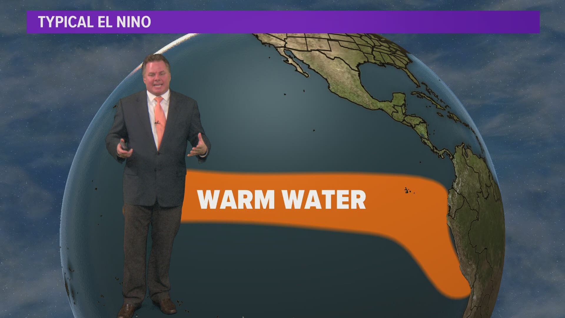
By definition, an El Niño pattern has a pocket of warmer than average ocean temperatures off the coast of Peru. When that warmer water is present, more heat and moisture get pumped into the atmosphere.
That extra energy can dramatically alter the position of the jet stream across all of North America. That’s key because the jet stream is what steers large areas of high and low pressure. If that track shifts, so does the area that’s most likely to deal with cold and snow.
This year’s El Niño differs from the classical definition because the warmer ocean temperatures are building a little farther to the west. That could result in an even more dramatic shift in the jet stream. That type of pattern could push the milder air destined for the East coast even farther east, out into the Atlantic Ocean. That could set up an avenue for arctic air from northern Canada to drop in to the Northeast U.S. from time to time. Such a pattern may also lead to unusual winter warmth in the Gulf of Alaska and that often translates to more cold air downstream in the East.
In short: this year’s breed of El Niño could actually lead to a colder, more stormy season than usual for the Eastern U.S.
WEB EXTRA: Explaining El Niño
We know what this year’s El Niño setup may look like, but what exactly does that mean for our temperature and precipitation outlook this winter?
We have gone back and looked at past years with setups such as this and compared them with what we are expecting this winter. There’s a clear connection to a colder season with this kind of pattern, but there’s less of a correlation when it comes to snowfall.
Snow forecasting around here is tricky because cold doesn’t always equal snow. We’ve had plenty of frigid winters with lower than average snowfall totals. However, with a warm Lake Erie this year and an early snow pack in central Canada along with plenty of cold air up there, the lake effect season should start with a bang.
That could be followed by some larger storms especially later in January into February that will deliver more cold air and snow for the Northeast. This year’s El Niño is expected to strengthen a bit for the second half of winter.
As the El Niño pattern becomes more prominent, we may see a shift in the jet stream once again. That shift may help lock some of that early season cold back up in the Arctic. But that doesn’t mean we can let our guard down when it comes to winter storms.
Another important forecasting tool uses a skill most of us developed in Pre-K: recognizing patterns. Meteorologists give it a more sophisticated term: analog forecasting.
It’s a tricky task. Our atmosphere is home to some of the most complex patterns on the planet. But even simple statistics like past snowfall can provide a glimpse into what may come. That’s one of the patterns Heather analyzed this time around.
Last year brought us over 100” of snow. Since 1945, that’s been the case for a little less than half of our snow seasons in Buffalo. That was used as a starting point.
From there, Heather looked to see what happened the year immediately after each 100 inch season. Interestingly, only 5 seasons were followed by a below average year. Keep in mind average snowfall is about 94 inches. Of those 5 season, only one involved a weak El Niño.
That was a key link this year. Only once has a weak El Niño been part of a setup that led to a quieter snow season. That could be a check in the box for this coming season to bring at least average snowfall, if not slightly above.
There are a few other patterns that can be divulged from this data and they’re explained here.
Any numbers geek would find these statistics interesting, but in the end, the past is the past and each season brings something different.
Curious about other winter trends across Western New York? Has snowfall been increasing or decreasing over the past 15, 30 years? Historical trends also can help us look forward when making our winter prediction.
Let’s put that all together. An El Niño is forecast to set up this winter, but in an unusual location and it won’t be prominent until the second half of the season. That means we’re calling for a colder than average winter with near to above average snowfall for Western New York.


