

BUFFALO, N.Y. — May is typically known as the month the most tornadoes during severe weather season, with reason stemming from seasonal jet stream patterns and the resulting number of severe weather outbreaks that occur with these weather set ups.
A perfect example of this was May of last year, with an especially active period from May 17 to May 30. An estimated 392 tornadoes touched down across the country during this time.
This included several destructive tornadoes with the classification of EF-3 or higher, such as the EF-3 Jefferson City tornado on May 22, EF-4 Dayton tornado on May 27, and EF-4 Lawrence, Kansas, tornado on May 28. This severe weather outbreak caused millions of dollars of damage and took the lives of eight people.
May of this year couldn't have been more different. Tuesday afternoon the Storm Prediction Center released its findings regarding the severe weather, or lack thereof, for May of 2020. Turns out this past May was one of the more anomalous months of severe weather season in recent memory.
In fact, May of 2020 ranks as number one for least amount of tornado watches issued for the month with records going back to 1970. Only 10 total tornado watches were issued across the country last month.
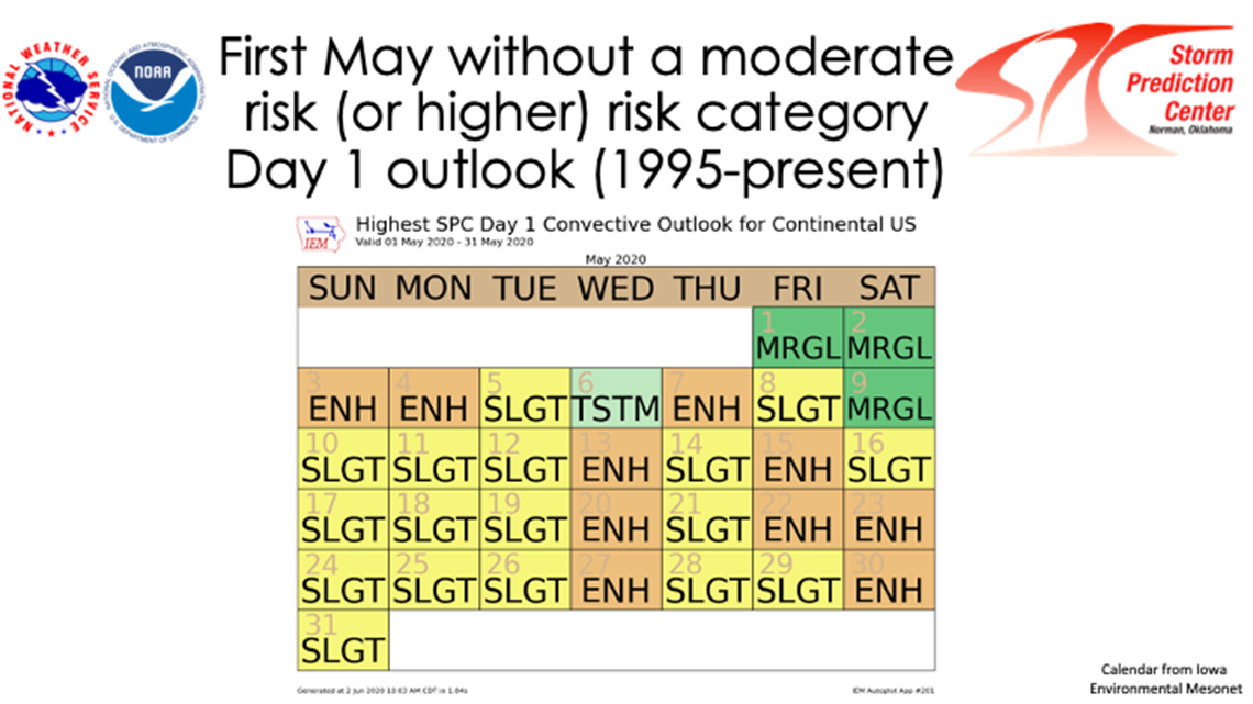
Another analysis shows that this was also the first year since 1995 without a moderate risk or higher included in SPC's Day 1 outlook (see calendar).

It can also be said that there was a noticeable lack of severe weather and storm reports all together. May of 2020 has the fewest storm reports since May of 2014 and fewest recorded tornadoes since at least 1970 when official record keeping began.
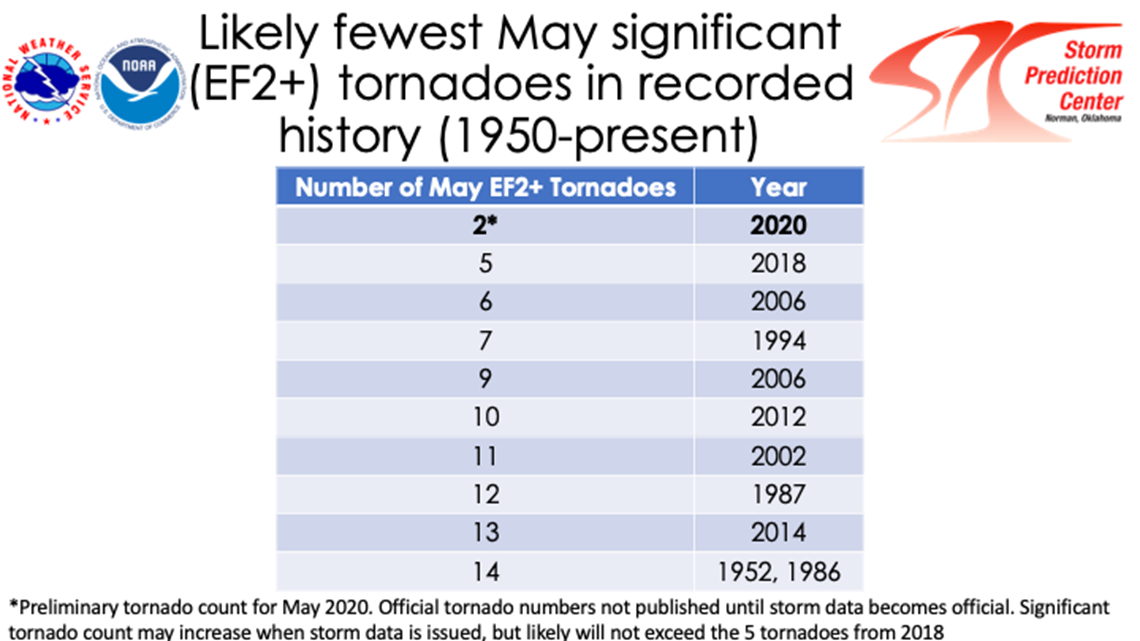
And compared to last May's numerous destructive tornadoes of EF-2 strength of higher, only two occurred last month. This sets a new record for fewest significant May tornadoes since 1950.

Further analysis will be needed to pinpoint exactly why this past was was unusually inactive. Blocking patterns which kept the Northeast cold and Midwest wet, plus a developing La Nina in the equatorial Pacific Ocean, all likely played a role. However, these teleconnection patterns is what also could lead to a more active 2020 Atlantic Hurricane Season.
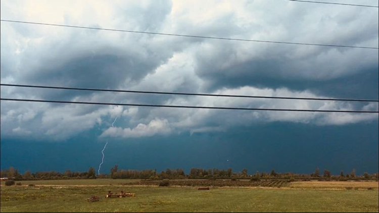
But June is already off to a roaring start, especially in the Northeast. Strong storms in Western New York brought golf ball size hail and 65 - 70 mph wind gusts Tuesday night with more severe storms possible across the Midwest and East Coast over the coming days.