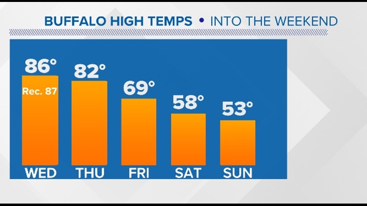
BUFFALO, N.Y. — A warming trend is expected into Wednesday with near record heat peaking mid week and sunshine into Thursday. But it will end abruptly as a cold front moves in for end of the week and through the weekend.
Highs in the mid 80s to even some upper 80s inland on Wednesday could near the record daily high of 87 set back in 1951. That is twenty degrees above average for this time of year.
By the weekend though, highs will only make it into the low 50s by Sunday (more than 10 degrees BELOW average). That is more than a 30 degree temperature drop, and feeling more like early November rather than the July-like temperatures mid week.
Rain is also expected to move in early Friday morning and the rain chance continues right through the long Columbus Day weekend with cooler air in place.
RELATED VIDEO:


