

BUFFALO, N.Y. — Enjoy the warmth and well-above-average temperatures this week because a major shift is going to happen in the weather pattern this weekend and especially early next week.
Cooler air moving in for the upcoming weekend will turn to colder air for early next week.
A cold front moving through may produce enough moisture for a rain and snow mix, especially for higher elevations later Monday night and into Tuesday. And once again a shot of cold air for Tuesday night, Halloween night, into early Wednesday. Plan on a cold Halloween evening for trick or treating. Highs will be as cold as our average lows, in the low 40s, and the low temperatures will be well below average too in the 30s. For areas south, could have highs in the 30s and lows in the 20s for the coldest day of the week on Tuesday, Halloween.
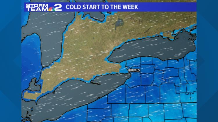
This strong cold front dropping down will bring cold air advection to our area and the cold west and northwesterly flow during Monday night and into Tuesday and Tuesday night, which could lead to lake-enhanced rain and even some snow mixing in too, mainly east and southeast of the lakes.
The first snowflakes of the season are certainly possible, and even some very minor accumulations for the higher elevations of the Southern Tier, at this point in the forecast.
High pressure moving in during Wednesday should dry things out some and allow temperatures to shift slightly upward as well.
Please keep checking in for updates as we get closer since we are still many days out.
RELATED |