BUFFALO, N.Y. — In a recent update from the Climate Prediction Center, climate forecasters expect the current La Niña conditions present over the eastern Equatorial Pacific Ocean to continue through this upcoming winter, potentially decreasing in strength next spring.
Forecasters noted the expansion and continuation of below-average sea surface temperatures across the Equatorial Pacific Ocean, the main staple of a La Niña. Couple that with an associated sea-to-air pattern, this La Niña is expected to continue throughout the Northern Hemisphere wintertime months. But a new development forecasters noted was the chance for this La Niña to weaken next spring, swinging back to ENSO neutral conditions starting as early as February.
El Niño Southern Oscillation is a large, naturally occurring ocean-to-atmosphere phenomenon located over the equatorial Pacific Ocean. Its positive phase is El Niño and the negative phase is a La Niña. It's closely monitored year-round as it can influence weather patterns across the Northern Hemisphere, especially during the fall, winter, and even spring months. With this in mind, here's how a La Niña could impact this winter.
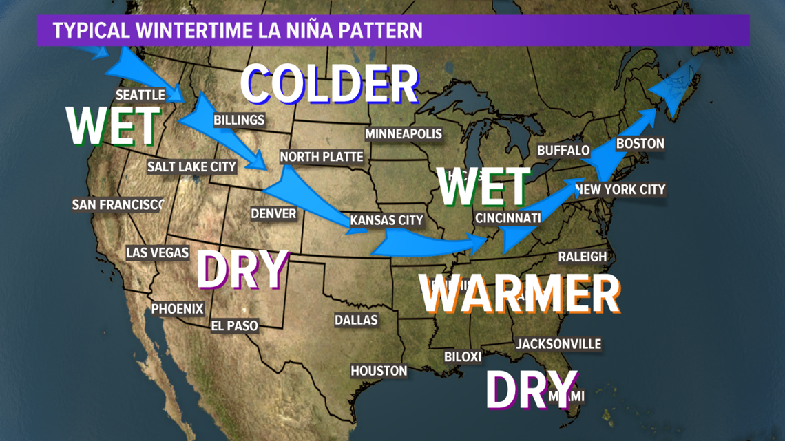
This unusually cold water by the equatorial Pacific can influence the position of the jet stream across North America, most notably from December to February. Typically a La Niña winter could lead to above-average precipitation and average temperatures for Western New York.


But the twist on this year's La Niña is that it will be present for a second winter in a row, with a previous La Niña present even the winter before that too. This is something Storm Team 2 will discuss in their upcoming Winter Weather Outlook in the coming weeks.

