
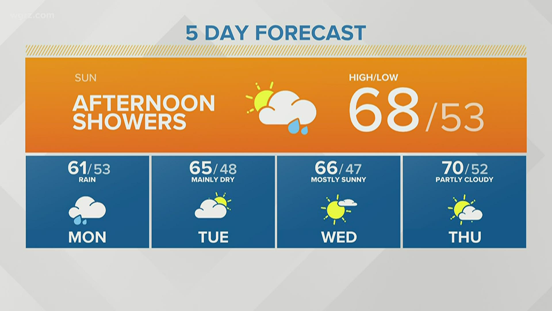
BUFFALO, N.Y. — From one extreme to the next, May's forecast is going from cold to rainy.
With the jet stream finally shifting in a more favorable, seasonal pattern over the Northeast, this could initially lead to a wetter weather pattern in the short term. A few rounds of showers, including some heavier rain and storms, are possible Sunday through Thursday.
For this heavy rain threat to happen, a couple of things in the atmosphere need to occur.
An area of low pressure will likely develop and track across the Northern Plains this weekend, while at the same time another storm will be gathering off the Atlantic coast. These two systems could work together and bring copious amounts of moisture into the Northeast and Great Lakes. It all depends on where the heaviest rain bands set up, which will likely happen farther north and west of Western New York.
So Western New York is only forecast to receive 1 to 3 inches of rain, but Lake Erie could see up to 4. With this in mind, lake-shore flooding could be a concern next week and rain accumulates across the region. Flash flooding is not a concern at this point, but localized flooding and swelling of rivers, creeks, and streams is.
It's important to note that these two weather systems are still developing through the weekend, which will dictate how these rainy days next week play out. n
Follow Storm Team 2 for the latest forecast.