
BUFFALO, N.Y. — Last year Buffalo picked up nearly two feet of snow on Christmas and the following day. But this year, the landscape across Western New York will look and feel quite different.
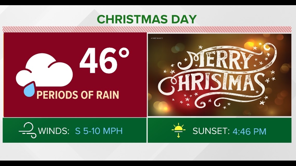
Any lingering snow will melt by Christmas Day, thanks to the warmer temperatures and rain in store for the holiday.
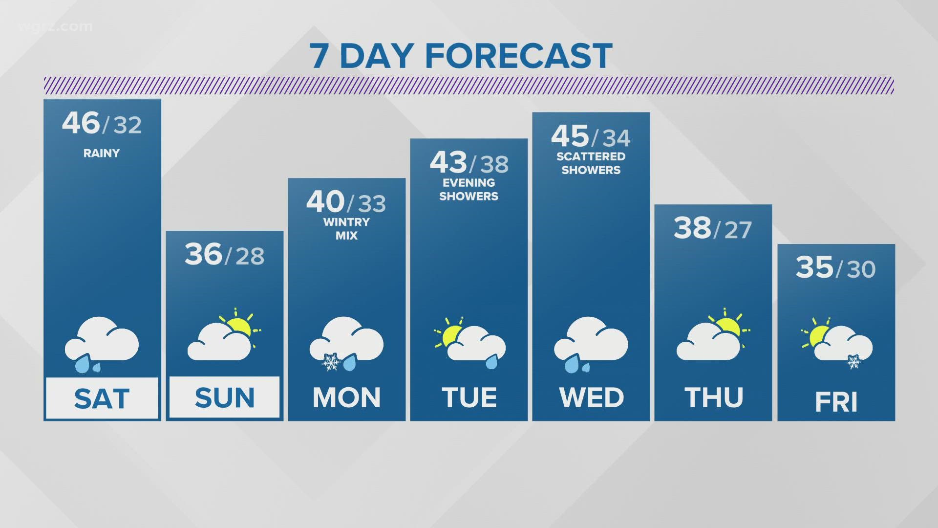
Christmas Eve will be another cloudy day with a few sun breaks in the morning. Winds will be light and eventually isolated showers will move in during the evening, becoming more widespread overnight as the next weather system moves in for the weekend.
A weak area of low pressure will sweep through the Great Lakes this weekend. And with temperatures above freezing, this system will bring rain instead of snow. Light showers follow for Friday night, becoming more widespread overnight for Saturday morning and last through the day.
Rain totals for Saturday could range between a quarter to upwards of three quarters of an inch, but most totals will be around half an inch. Otherwise, temperatures will start in the upper 30s Christmas morning and rise into the mid 40s later in the day.

Cooler air will swirl into the region Saturday night. Sunday will be a colder and cloudy day still with afternoon high temperatures only reaching the mid 30s.
In the past 10 years, there have been seven white Christmases (at least 1 inch of snow on the ground). This year will not make eight.