A deluge of rain started early Friday, and just won't stop in New York City. Nonstop rainfall from the Atlantic Ocean was pointed right over Brooklyn and Queens causing massive flooding. What's going on to cause this level of weather disaster? We asked Chief Meteorologist Tim Buckley of WFMY News 2 to weigh in.
'A Firehose of Moisture'
To get this level of flooding you need a ton of rain in a short period of time. There are no hurricanes and no tropical storms, so where is all this rain coming from?
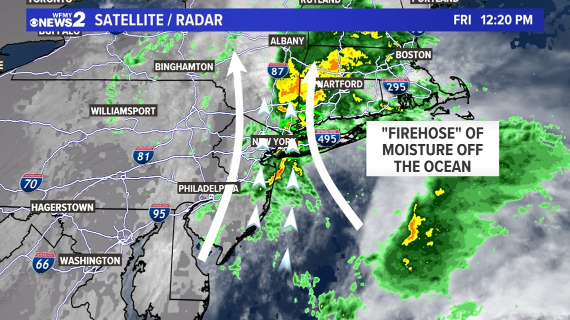
"It's basically like a firehose of moisture is pointed at New York City," said Chief Meteorologist Tim Buckley. "A narrow line of rain was pointed at Brooklyn basically all morning, without shifting very much at all."
Atmospheric winds are converging over the Atlantic Ocean creating a heavy band of rain. It's oriented south to north from the ocean toward the five boroughs of New York. Much of Friday, torrential rain was oscillating back and forth over the city, with the highest amounts over Brooklyn and Queens.
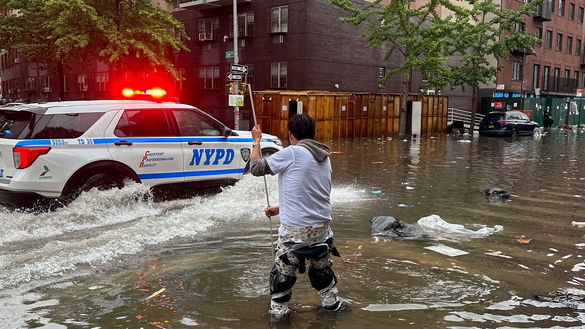
It's already been a wet September in New York, and this rainfall doesn't have anywhere to go. Not to mention, this is the biggest city in the country with pavement and concrete everywhere. Most of the water is running off and overflowing drains. Streets, subways, and even parts of LaGuardia airport were flooded Friday.


A New Rainfall Record
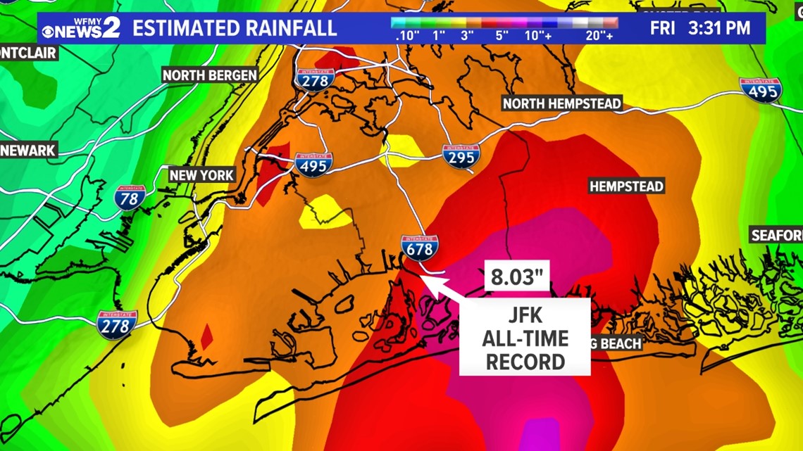
At JFK Airport in Queens, Friday will go down as the wettest day on record. As of 3:30pm, over 8 inches of rain had fallen making it the wettest day there since records began in 1948. More rain was expected the rest of the day.
The city-wide rainfall record in New York is 8.28" back in 1882. It's possible that may be exceeded by the end of the day as well.


"Life-Threatening Flooding"
The flooding reports are too numerous to list on a day like today. Several roads and highways across the city were completely flooded and submerged in water. LaGuardia Airport suffered flooding in Terminal A and needed to evacuate that area. It remains closed until the water recedes.

